

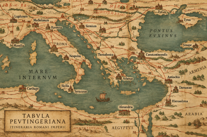
The Tabula Peutingeriana is an amazing map. It shows roads, cities and major towns, and physical geographic features across the Roman world as represented in late antiquity. It also extends beyond the Roman Empire, including places farther east. Besides being interesting to look at, the map was useful for understanding routes and waypoints while travelling across the empire.
Today people use tools like Google Maps to plan travel. What if, in some sort of amazing wonder/nightmare world, the Romans had technology like Google Maps?
The Romans would then use Omnes Viae: Itinerarium Romanum, a Roman route planner based on historical sources including the Tabula Peutingeriana. Using a Latin veneer, Omnes Viae shows not only a route through the Roman road network but also the towns, villages, river crossings and other features one would pass along the way.
I planned a trip from the Eternal City to Jerusalem. Basically, one would take a nice excursion through major cities of the Eastern Roman world, including Belgrade, Constantinople, Antioch and Beirut.
What Is the Tabula Peutingeriana?
The surviving Tabula Peutingeriana is not an original map manuscript from around A.D. 400. It is a late 12th-century parchment copy of an ancient Roman road-map tradition.
UNESCO describes it as the unique surviving map of the cursus publicus, the Roman Empire’s public road and communications network. Its purpose was not to reproduce geography in the way a modern map does, but to show the structure of routes, settlements and connections across the network.
Omnes Viae Today
Omnes Viae remains available as a Roman route planner. Its main historical source is the Tabula Peutingeriana, supplemented in areas where the surviving map is incomplete by information from the Itinerarium Antonini.
The project calculates routes using distances recorded in these ancient sources, making it a useful modern way to explore how travel through the Roman road network might have been planned.
So while “Google Maps from AD 400” was always a playful comparison, Omnes Viae still captures the basic idea remarkably well: choose a starting point and destination, then follow the routes and stopping places available to a traveller in the Roman world.
Leave a Reply