

The Four Corners states are Arizona, Colorado, New Mexico, and Utah. These four states meet at a single geographic point in the American Southwest, making Four Corners the only place in the United States where the boundaries of four states intersect.
The exact meeting point is marked by the Four Corners Monument, a Navajo Tribal Park where visitors can stand at the intersection of all four states.
Utah is northwest of the monument, Colorado is northeast, Arizona is southwest, and New Mexico is southeast.
What Are the Four Corners States?
The four states that make up the Four Corners are:
- Arizona
- Colorado
- New Mexico
- Utah
Congress has formally recognized the Four Corners Monument as the only geographic location in the United States where four state boundaries meet.
| Position at Four Corners | State |
|---|---|
| Northwest | Utah |
| Northeast | Colorado |
| Southwest | Arizona |
| Southeast | New Mexico |
This arrangement creates what geographers call a quadripoint, a location where four separate geographic or political boundaries meet at one point.
Where Do the Four Corners States Meet?
Arizona, Colorado, New Mexico, and Utah meet at the Four Corners Monument in the southwestern United States.
The monument lies within the Navajo Nation and is operated by Navajo Nation Parks & Recreation as a Navajo Tribal Park.
At the center of the site is a marker showing the exact legal point where the four state boundaries intersect. Each state name is displayed in its respective quadrant around the central marker.
The location is remote compared with major U.S. cities, but it has become one of the most recognizable geographic landmarks in the American Southwest.
Which State Is in Each Corner?
If you look at a map of Four Corners, the four states are arranged like this:
- Utah: Northwest
- Colorado: Northeast
- Arizona: Southwest
- New Mexico: Southeast
This arrangement makes the monument easy to understand once you are standing at the central marker. Moving in a different direction from the center places you in a different state.
1. Arizona
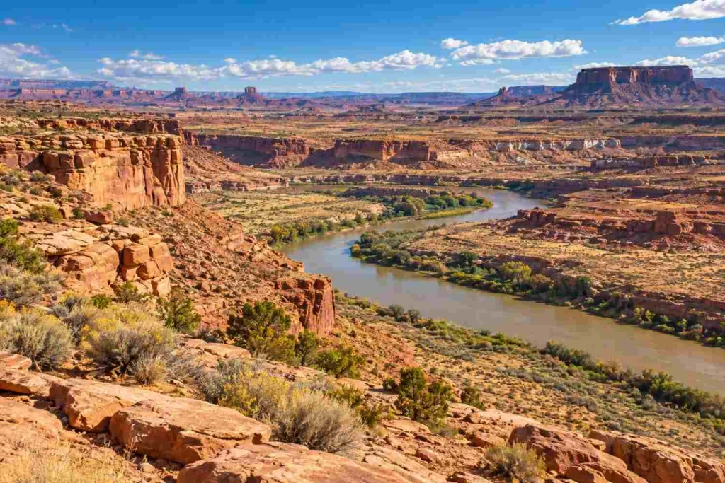
Position: Southwest of Four Corners
Arizona occupies the southwestern quadrant of the Four Corners intersection.
The northeastern corner of Arizona meets Utah to the north and New Mexico to the east. Colorado touches Arizona only at the common Four Corners point.
This distinction is important because Arizona and Colorado do not share a traditional border segment. They touch only at the quadripoint.
Northeastern Arizona is part of the Colorado Plateau, a large geographic region known for high desert terrain, mesas, plateaus, canyons, and dramatic rock formations.
2. Colorado
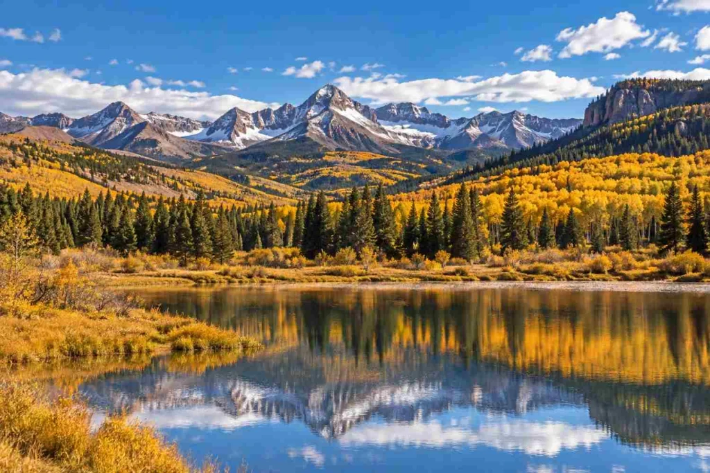
Position: Northeast of Four Corners
Colorado occupies the northeastern quadrant of the Four Corners intersection.
Utah lies directly to its west, while New Mexico lies directly to its south. Arizona reaches Colorado only at the precise Four Corners point.
The southwestern part of Colorado differs considerably from the high peaks typically associated with the central Rocky Mountains. The broader Four Corners region includes mesas, canyons, high desert landscapes, and archaeological sites.
Mesa Verde National Park is located in southwestern Colorado relatively close to the Four Corners region. The National Park Service describes the area’s landscape as a mix of forested mountains, mesas, and broad sagebrush plains.
3. New Mexico
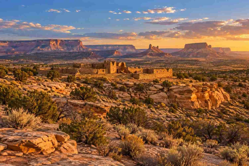
Position: Southeast of Four Corners
New Mexico occupies the southeastern quadrant of the Four Corners.
Colorado lies immediately north of New Mexico at this point, while Arizona lies to the west. Utah touches New Mexico only at the common Four Corners marker.
The northwestern portion of New Mexico shares many characteristics with the broader Colorado Plateau, including desert landscapes, sandstone formations, mesas, and areas of important Indigenous cultural history.
4. Utah
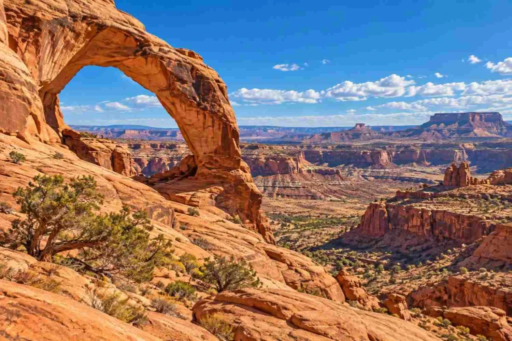
Position: Northwest of Four Corners
Utah occupies the northwestern quadrant of the Four Corners intersection.
Colorado lies to its east and Arizona lies to its south. New Mexico touches Utah only at the exact Four Corners point.
Southeastern Utah is known for dramatic Colorado Plateau landscapes characterized by sandstone cliffs, canyons, mesas, and desert terrain.
The Four Corners point therefore sits within a much larger geographic region that shares similar landscapes across state boundaries.
Why Is Four Corners Unique?
Four Corners is unique because it is the only place in the United States where four state boundaries meet at a single point.
Congress specifically identified this distinction in the Four Corners Interpretive Center Act, noting that Arizona, Colorado, New Mexico, and Utah meet at the monument.
Many states meet one another along straight or irregular borders, and three-state meeting points are relatively common. A four-state intersection, however, is much more unusual.
That makes Four Corners both a geographic curiosity and a popular travel stop.
Can You Stand in Four States at Once?
Yes. Visitors can position themselves over the central Four Corners marker so that part of their body is in Arizona, Colorado, New Mexico, and Utah at the same time.
This is one of the best-known activities at Four Corners Monument and a major reason travelers visit the site.
The monument plaza clearly identifies each state, making it easy to see where one state ends and another begins.
Is the Four Corners Monument in the Correct Location?
One of the most persistent myths about Four Corners is that the monument is in the “wrong” location because modern GPS measurements do not place it exactly where someone might expect based on ideal lines of latitude and longitude.
That claim oversimplifies how legal boundaries work.
The state borders were established through historical surveys. Once officially accepted, those surveyed lines and monuments became the legal boundaries, even if early surveying methods did not reproduce a theoretical latitude or longitude line with modern GPS precision.
Historical records from the Bureau of Land Management document the survey history of the Four Corners point and identify the marker as the common corner of Arizona, Utah, Colorado, and New Mexico.
In other words, the monument marks the legally recognized Four Corners location.
The key distinction is between:
- A theoretical location calculated from latitude and longitude
- The surveyed and legally established state boundary
For state boundaries, the legally established survey controls the location.
How Was the Four Corners Boundary Created?
The Four Corners point developed as federal surveyors established territorial and state boundaries across the western United States during the 19th century.
Congress noted that the boundary lines creating the Four Corners were drawn between 1868 and 1875.
Historical federal surveying records show that several surveyors worked on different state and territorial boundary lines over time.
The Four Corners point eventually became the recognized common corner where the boundaries of Utah, Colorado, New Mexico, and Arizona intersect.
Different markers have been used at the location over the years as the site was improved and reconstructed.
What Is a Quadripoint?
A quadripoint is a geographic location where four distinct territories meet at one point.
At Four Corners, those four territories are U.S. states:
- Arizona
- Colorado
- New Mexico
- Utah
The Four Corners quadripoint is particularly notable because there is no other location in the United States where four state boundaries meet in this way.
Four Corners Monument vs. the Four Corners Region
The terms Four Corners Monument and Four Corners region are related, but they do not mean exactly the same thing.
Four Corners Monument
The Four Corners Monument refers to the precise geographic point where Arizona, Colorado, New Mexico, and Utah meet.
The site is managed by Navajo Nation Parks & Recreation and includes the central boundary marker, visitor areas, and Navajo vendors.
Four Corners Region
The Four Corners region is much larger.
It broadly refers to the portions of Arizona, Colorado, New Mexico, and Utah surrounding the common boundary point.
The region includes high desert landscapes, plateaus, mountains, mesas, canyons, tribal lands, historic communities, and archaeological areas.
So, while the monument is a single point, the Four Corners region can extend for many miles in every direction.
Is Four Corners Monument a National Monument?
No. Despite its name, Four Corners Monument is not a National Park Service national monument.
It is a Navajo Tribal Park operated by Navajo Nation Parks & Recreation.
This distinction matters when planning a visit because federal National Park Service passes and policies should not automatically be assumed to apply.
Four Corners Monument Hours
According to Navajo Nation Parks & Recreation, Four Corners Monument currently operates on seasonal hours:
| Dates | Hours |
|---|---|
| May 23 to August 14 | 8:00 AM to 8:00 PM |
| August 15 to September 30 | 8:00 AM to 7:00 PM |
| October 1 to March 27 | 8:00 AM to 5:00 PM |
| March 28 to April 30 | 8:00 AM to 6:00 PM |
| May 1 to May 22 | 8:00 AM to 7:00 PM |
The park is also closed on major Navajo Nation holidays, including New Year’s Day, Thanksgiving Day, Navajo Nation Family Day, Christmas Day, and other Navajo Nation holidays.
Because operating hours and fees can change, check the official Four Corners Monument page before traveling.
What Can You Do at Four Corners Monument?
The main reason to visit is the central Four Corners marker, but there are several things visitors can do while at the site.
Stand in Four States at Once
The classic Four Corners experience is positioning yourself over the marker so that you are physically touching all four states.
Take Photos at the Monument
The state names and boundary lines around the central marker make it one of the most recognizable geography-themed photo opportunities in the United States.
Visit Navajo Vendors
Navajo Nation Parks & Recreation notes that vendors at the monument sell handmade jewelry and traditional Navajo food.
Buying directly from local vendors can also make a visit more meaningful than simply stopping for a photograph.
Learn About the Region
Four Corners is located within a culturally and geographically significant part of the Southwest. Visitors can use the stop as an introduction to the wider landscape and Indigenous history of the region.
What Does the Four Corners Region Look Like?
The Four Corners region is part of the broader Colorado Plateau.
Its landscapes vary considerably but often include:
- Mesas
- High desert
- Canyons
- Sandstone cliffs
- Sagebrush plains
- Pinyon and juniper woodland
- Mountainous areas
The National Park Service describes the nearby Mesa Verde area as a landscape of forested mountains and mesas separated by broad sagebrush plains.
This combination of desert and higher-elevation terrain is one reason the broader Four Corners region looks so different from many other parts of the United States.
Do Arizona and Colorado Share a Border?
Arizona and Colorado touch at the Four Corners point, but they do not share a conventional border line.
The same is true for Utah and New Mexico.
Arizona’s northern border meets Utah, and its eastern border meets New Mexico. Colorado sits diagonally northeast of Arizona.
Therefore, Arizona and Colorado meet only at one point rather than along a measurable stretch of boundary.
Do Utah and New Mexico Share a Border?
Utah and New Mexico also meet only at the Four Corners point.
They sit diagonally from each other, with Colorado between them to the northeast and Arizona to the southwest.
As with Arizona and Colorado, there is no conventional Utah–New Mexico border segment.
Four Corners States at a Glance
| State | Position | States It Directly Borders at Four Corners |
|---|---|---|
| Arizona | Southwest | Utah and New Mexico, with Colorado touching at the common point |
| Colorado | Northeast | Utah and New Mexico, with Arizona touching at the common point |
| New Mexico | Southeast | Arizona and Colorado, with Utah touching at the common point |
| Utah | Northwest | Arizona and Colorado, with New Mexico touching at the common point |
The Bottom Line
Arizona, Colorado, New Mexico, and Utah are the four Four Corners states.
They meet at one precise point at Four Corners Monument, with Utah to the northwest, Colorado to the northeast, Arizona to the southwest, and New Mexico to the southeast.
What makes the site particularly unusual is that it is the only place in the United States where four state boundaries intersect at a single point.
The monument also sits within a much larger Four Corners region shaped by the landscapes, history, cultures, and geography of the American Southwest.
FAQ’s
The Four Corners states are Arizona, Colorado, New Mexico, and Utah. Their boundaries meet at one point at Four Corners Monument.
Arizona, Utah, Colorado, and New Mexico meet at the Four Corners. Utah is northwest, Colorado northeast, Arizona southwest, and New Mexico southeast.
Four Corners is located in the American Southwest at the common boundary point of Arizona, Colorado, New Mexico, and Utah. The monument is within the Navajo Nation.
Four Corners Monument is the only location in the United States where the boundaries of four states meet at one point.
Yes. Visitors can stand over the central Four Corners marker so that different parts of their body are positioned in Arizona, Colorado, New Mexico, and Utah simultaneously.
No. The monument marks the legally established intersection of the four state boundaries. Claims that it is misplaced usually compare historical surveyed boundaries with ideal modern latitude and longitude calculations, which are not the same thing.
Utah occupies the northwest quadrant of Four Corners.
Colorado occupies the northeast quadrant.
Arizona occupies the southwest quadrant.
New Mexico occupies the southeast quadrant.
No. Four Corners Monument is a Navajo Tribal Park managed by Navajo Nation Parks & Recreation, not a National Park Service site.
Four Corners can be worth visiting for travelers interested in U.S. geography, road trips, the American Southwest, or the experience of standing in four states at once. It is best viewed as a distinctive geographic stop rather than a large destination requiring an entire day.